Description
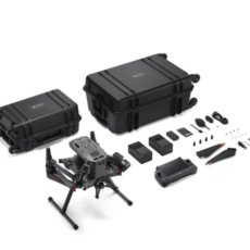
What’s Included
-
Remote Controller ×1
-
Propeller Pair ×3
-
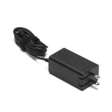
Charger ×1
-
Carrying Case ×1
-
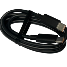
USB-C to USB-C Cable ×1
-
Power Cable ×1
-
USB-C Cable ×1
-
Screwdriver ×1
-
Manuals
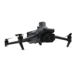
See the Invisible. Grow With Precision.
Aerial surveying requires the ability to see beyond what the human eye can detect.
The DJI Mavic 3 Multispectral (M3M) offers dual vision—a high-resolution RGB camera paired with a multispectral camera—to help you scan fields, evaluate crop health, and make confident agronomic decisions based on real data.
Built for precision agriculture and environmental monitoring, the M3M provides the accuracy, speed, and reliability needed for professional crop management.
Integrated Imaging System
The M3M features an advanced imaging unit that includes:
-
One 20MP 4/3” CMOS RGB camera
-
Four 5MP multispectral cameras (Green, Red, Red Edge, Near-Infrared)
This combination enables detailed vegetation analysis, NDVI mapping, plant stress detection, and accurate field scouting.
RTK Precision – Centimeter-Level Accuracy
The aircraft comes equipped with a dedicated RTK module.
Flight control, the camera, and the RTK module synchronize in microseconds to pinpoint the exact location of each image’s center.
This allows the M3M to perform high-accuracy mapping without the need for ground control points (GCPs).
Omnidirectional Obstacle Avoidance & Terrain Follow
Multiple wide-angle sensors provide obstacle detection in all directions.
In uneven or hilly areas, terrain-follow mode automatically adjusts altitude, enabling smooth and safe surveying even in steep environments.
Long Flight Time & Extended Range
-
Up to 43 minutes of flight time
-
Up to 15 km transmission range
-
Reliable O3 communication system with strong anti-interference
-
Efficient propulsion for long missions
This allows you to cover more acres per flight with consistent data quality.
Questions About Applications? We’re Here to Help.
If you have any questions about how to use the M3M for crop surveying, vegetation analysis, NDVI, or workflow planning, feel free to contact us.
We are happy to recommend the best setup based on your crops, acreage, and project goals.
Training & Support
If you’re new to drones or unsure about operating the equipment and software, don’t worry!
As agricultural drone application specialists, we provide:
-
Hands-on flight training
-
Crop surveying workflow instruction
-
Software processing guidance (DJI Terra, DJI SmartFarm, and others)
-
On-site or remote technical support
We’re here to make sure you feel confident using your equipment and getting the most value from it.