
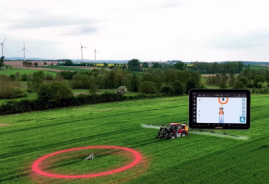
Drone Mapping → Tractor Auto-Steer Integration
✔ High-precision field maps generated by drones
✔ How maps are imported into auto-steer systems
✔ Variable-rate fertilizing & seeding
✔ Reduced overlap and lower fuel consumption
Benefit:
More precise operations. Less waste. Higher efficiency.
Multispectral Technology for Barn & Livestock Protection
✔ Detect localized overheating in barns
✔ Monitor livestock heat stress
✔ Assist in emergency search situations
Benefit:
Reduced risk. Protection for both lives and assets.
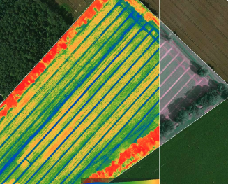
Multispectral vs Satellite Imagery — What’s the Difference?
✔ Satellite limitations (resolution, cloud cover, update delays)
✔ Drone-based multispectral precision & real-time data
✔ Application for targeted variable-rate spraying
Benefit:
Earlier detection. More accurate treatment decisions.
Soil Nutrient & Land Management Applications
✔ Identify variability within individual fields
✔ Combine aerial data with soil test results
✔ Move beyond one-rate-fits-all fertilization
Benefit:
Lower input costs. Improved return per acre
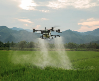
How Agricultural Drones Improve Yield
✔ Precision spraying with reduced overlap
✔ No crop trampling
✔ Lower labor & machinery costs
Benefit:
Lower operational cost. Higher productivity.
The Future of Farm Automation
✔ Auto-steer integration
✔ Drone–machinery coordination
✔ Data-driven decision systems
Benefit:
More sustainable. More efficient. Safer operations.
The Core Purpose of This Field Show
This event is not built around selling equipment.
It is built around helping farmers:
- Reduce production risk
- Lower input costs
- Increase crop yield
- Improve operational safety
- Understand where agricultural technology is heading
This is a real-field demonstration event — not a PowerPoint conference.
We will showcase:
✔ Live operations
✔ Real performance data
✔ Practical field applications
WONDERFULL INC.
Sales I Academy I Services I Parts
Office: 647 800 7952
Text : 647 287 6851
Address: 5955 10 Sideroad Innisfil, ON L0L 1K0