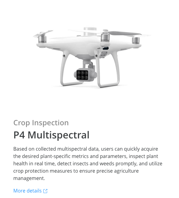
DreieichWhat is the role of DJI P4M Multispectual drone? Do I need it?
The function of RTK-enabled P4M is to quickly obtain accurate and precise multi-spectral data of crops, generate an expanded prescription map, which can help you judge the growth of crops and provide a more accurate data reference for crop management.
The drone is far, far more precise than all of the drones we’ve used previously,” he adds.
For a group insuring and servicing roughly half of the farmers in France, DJI has proven the solution that works the best.
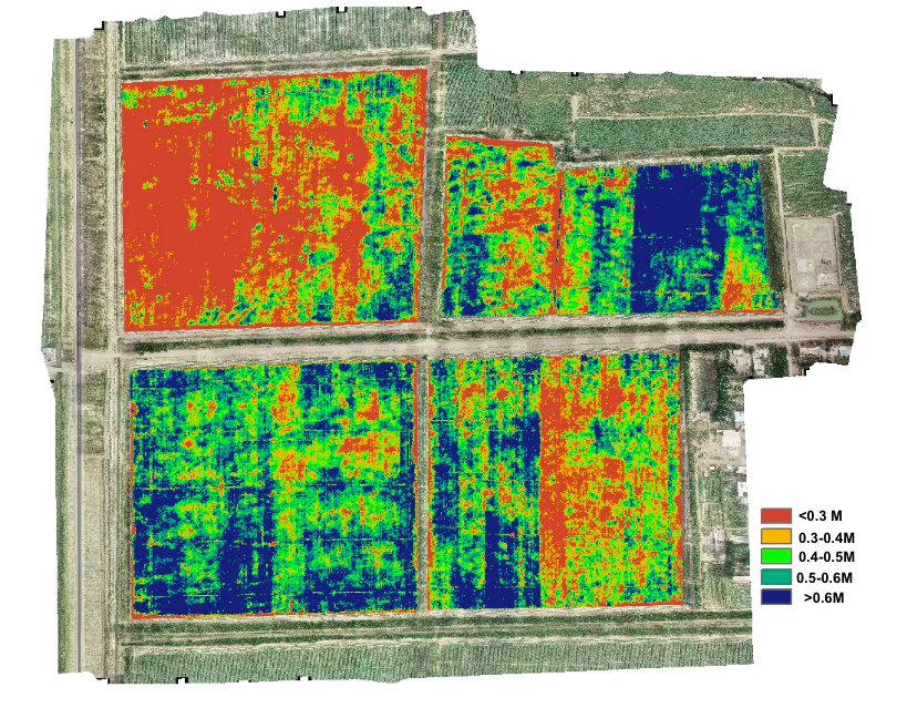
How to effectively measure and quantify crop losses, and how to quickly determine the areas where crop growth is the weakest, and applying additional nitrogen to these areas can increase yields.
Article sharing: How does precision agriculture work with Pix4D software? How does it cut down ripening agent costs by 20% and provided a 93% accuracy rate in crop yield forecasting.
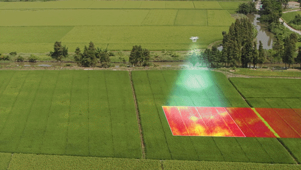
Through the P4M multi-spectral drone diagnose the change of the multi-spectral vegetation index, the undernourished area can be found in time, and then the DJI Agras drone of DJI can be used for variable operation. This is how you see the crop colour of the picture in PDF becoming more and more uniform.
DJI drone technology provides a perfect and easy agricultural solution for such needs.
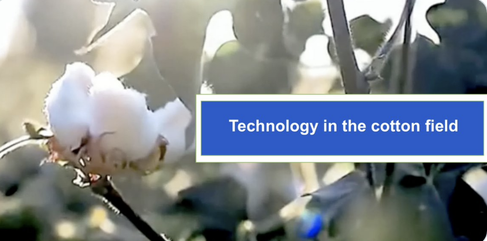
After the disaster, whether to re-seed or not to re-seed, he used multispectral technology to help his farm make a choice. Also welcome to click to browse the video “Drone Technology in cotton” for reference.
Is that helpful to the detection of maize Tarspot?
Article sharing:
An Understudied Disease Threatening Corn Production in the Americas
This virus can survive the winter, and crops need to be controlled in time before symptoms appear. Spraying drones are a good application.
This video is really great, love it!The data of DJI multi-spectral drones can be read and analyzed through Pix4D, and can be used on your harvester, which is more accurate, precise and timely than satellite images.Combined with DJI Agras T20, variable spraying/seeding operations can be realized, thereby reducing costs and increasing benefits.
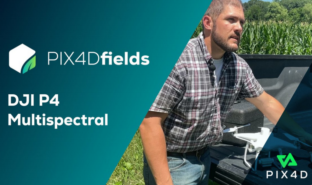
Pix4D’s Nathan Stein walks you through the entire workflow from flight planning, calibrating, data capture, to processing in PIX4Dfields. Enjoy the video.
Our company has satellite multispectral software. Can I upload the data to my DJI’s spraying drone for operation?
Please contact us for the correct file format. You can apply these data to DJI’s spraying drones for variable operations.
After finding the problem area with a DJI P4M, the multi-spectral drone, the data can be uploaded to the T20 through DJI Terra software to perform variable spraying or sowing operations on the problem area, which greatly improves the precision management of farmland.
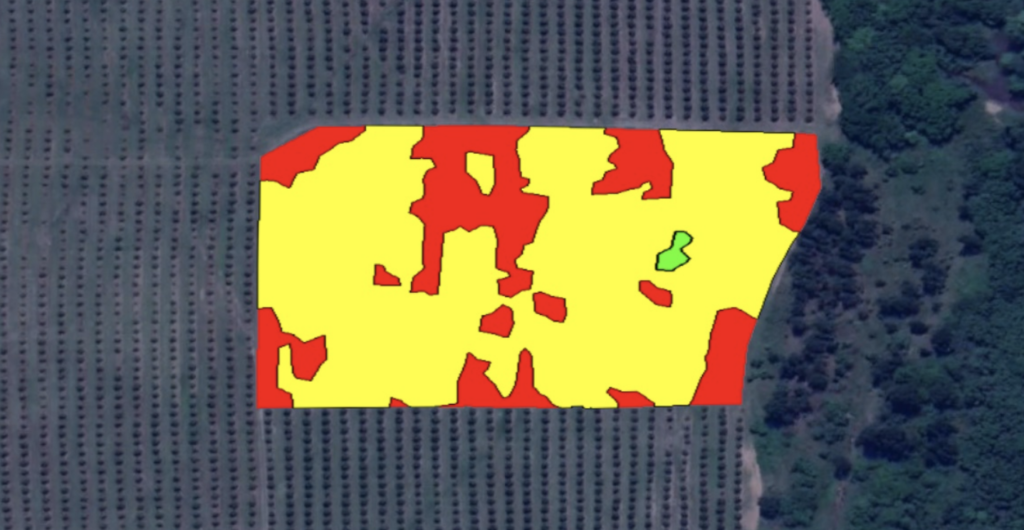
Thanks for PACSys the great photo!
How to obtain the farmland prescription map?
You can not only see the crop growth analysis graph directly from your Apple Device, but alsothe data can be read by DJITerra and directly imported into the spreading/seeding T20/T30/T10 drone for variable operations depending on the crop’s growth health in different areas, allowing for more efficient and accurate spraying to save your expenditure while improving crop’s quality.
How is variable fertilization achieved?
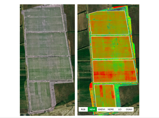
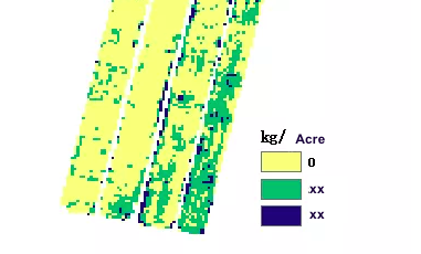
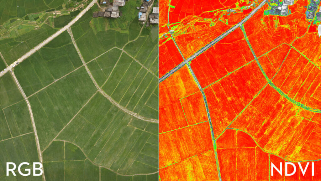
It can be seen from the NDVI index graph that there is a big difference in field growth in the late tillering stage. Based on this NDVI map, the agronomist divided the field growth and formulated the fertilization rate gradient: 0kg/acre (no fertilizer), xxkg/acre, xxkg/acre, and generated a fertilization prescription map. Subsequently, the prescription map was imported into Agras drones, and the variable fertilizer operation was carried out.
What is the difference between P4M and P4RTK?
The role of P4M is to generate a graph of the plant’s health index. The precision accuracy can reach 2cm, compared with satellite, it offers you more clear, accurate, and in time crop’s health data.
The P4M is not for mapping purposes, the P4M has a 2MP RGB Camera whereas the P4RTK has a 20MP RGB Camera. The P4M should only be used for multispectral mapping/prescription.
How to set up P4 Multispectral | Mapping Missions?
Gather precise plant-level date with the P4 Multispectral-a high precision drone built for agricultural missions, environmental monitoring, and more. Click here to see how to do map missions.
DJI Agras drones can perform variable spraying operations in the field based on the accurate crop analysis data of the farmland.This means that you only need to spread more fertilizer in areas with weaker growth, and spread less or no fertilizer in areas with good growth, thereby further increasing crop yields, reducing costs and ultimately increasing planting profits.
The variable seeding function of Agas drones can achieve precise control, fine seeding and reduce fertilizer cost by 10-15%.
What is the difference between satellite multi-spectual and DJI P4M multi-spectual drone?
Satellite multi-spectrum covers a large area, but the accuracy is not really that high. At the same time, affected by the weather, data transmission is not so timely.
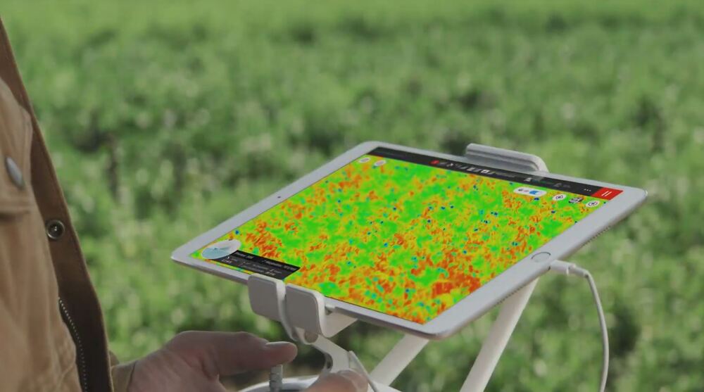
You can take DJI’s multi-spectral drone, P4M to the farmland for crop health monitoring and management at any time. Through your Apple devices display, you can see the crop health status of the farmland in real time for timely management and coordination.
At the same time, the crop health data in DJI’s multi-spectral drone can be read through DJI Terra software and uploaded directly to the T20 spraying/seeding drone for automatic variable spraying/seeding/fertilizing operations.