
Here’s a sample of P4M Terra software
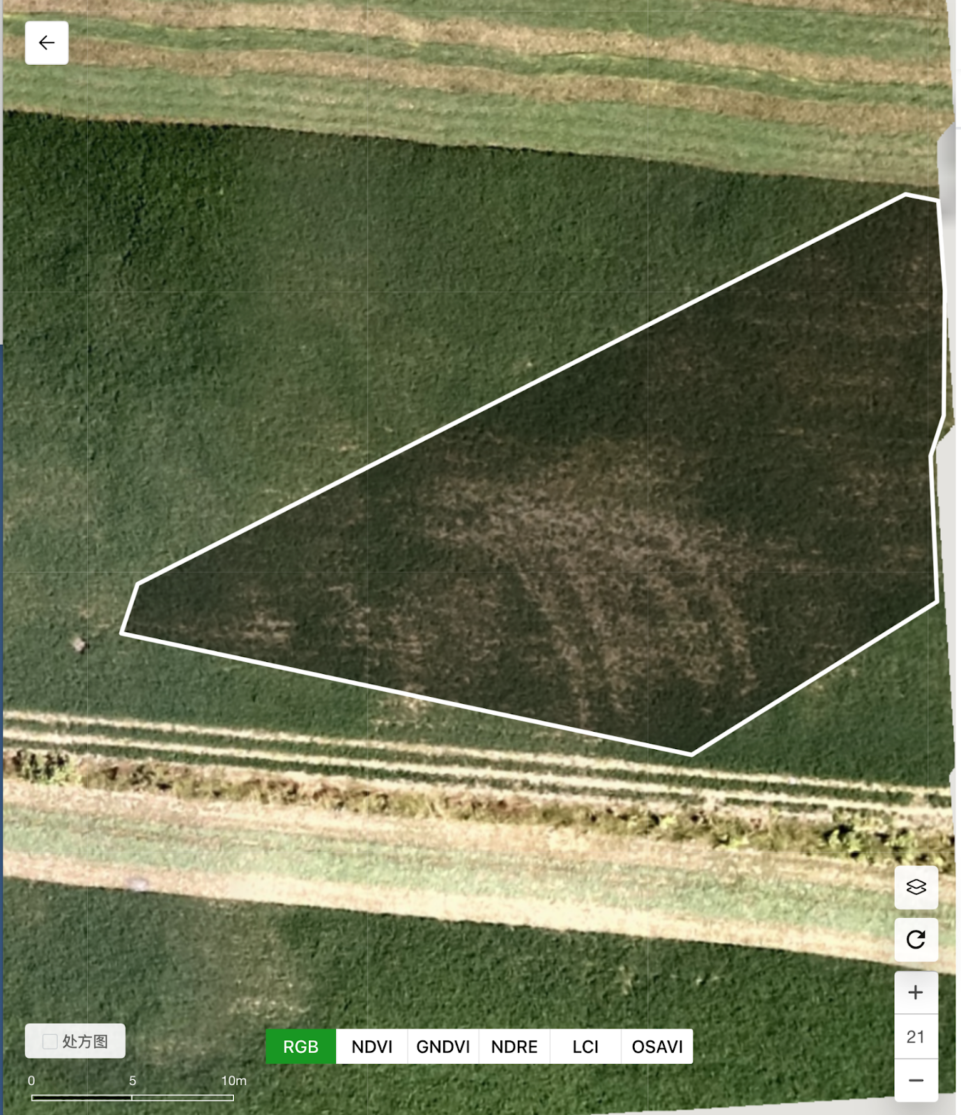
First, you got the farm multispectural map out (after uploading all the photos, we used about 10 minutes to generate this VR map). This is how it looks in DJI’s Terra software.

P4M is an integrated high-precision multispectral imaging drone launched by DJI in 2019. It is mainly used to monitor the growth and health of crops, and you can accurately see the crop conditions and water stress map through the software.

You can shift the RGB image to any of these spectral images easily.
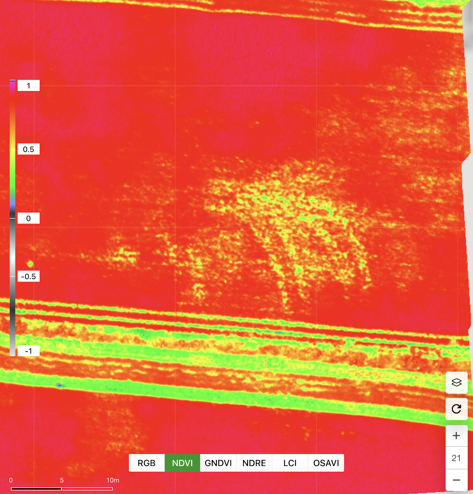
You can zoom in to see the details for unhealthy areas. In some software, red means death, in DJI Terra software, the areas in red are the areas with the most biomass and vice versa. We usually use this map to directly judge the areas that need to be inspected and judged. At the same time, with Terra software, you can directly create variable job maps, whether spreading fertilizers or spraying liquids.

Then you can select the problem area and do VR application.
The above is our cloud version Terra software, DJI is going to have an English version by the end of this year.
The desktop version of Terra software has all kinds of language selections.
You can use google translate to read Chinese on screen for now.
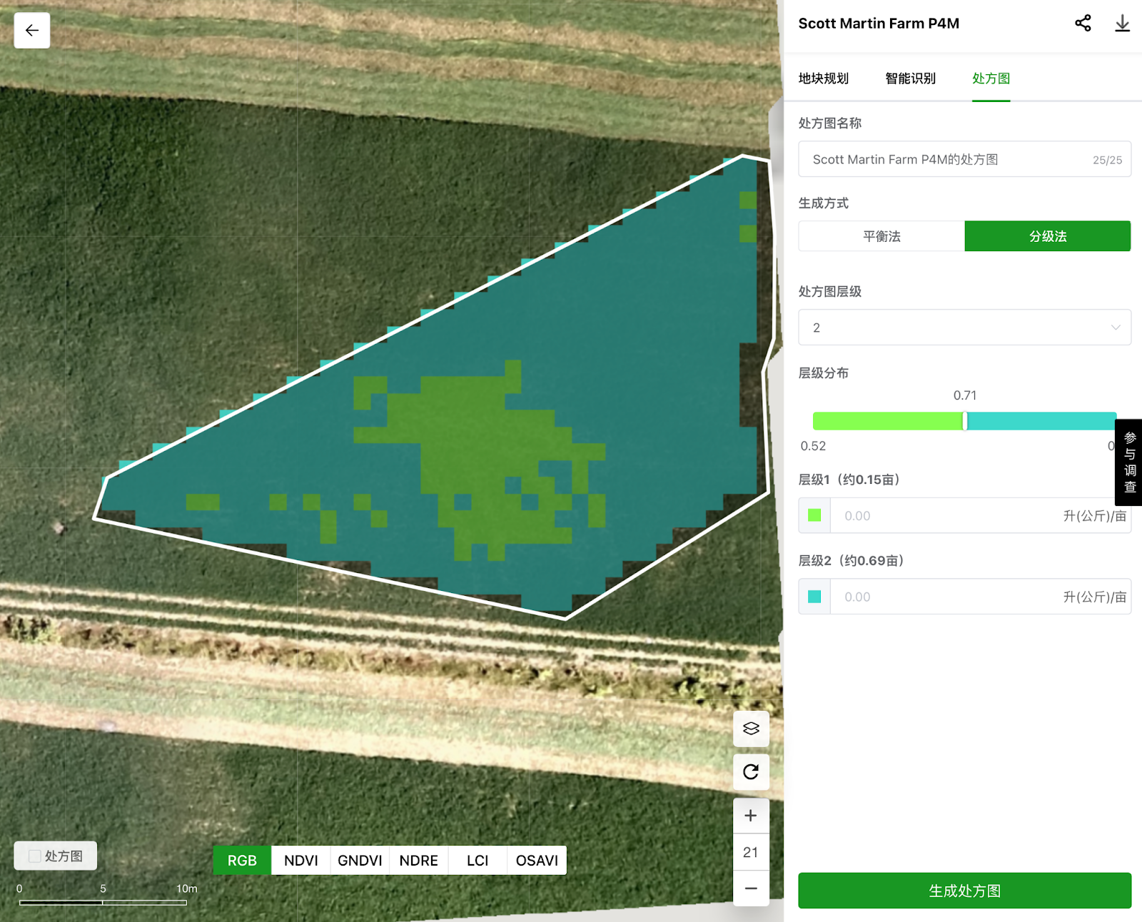
This is a total of 0.15 acres. You can make 5 levels in total, in this software, we choose 2 layers so that you can see the light green area is the place we need to take care of. So that you can input your rate accordingly.
This VR map can be read directly by the DJI Agras drone for the target spray/seeding/replanting.

You can also adjust the VR ratio by sliding the bar area.

The software can also easily analyze the high and low terrain so that you can better manage water stress areas.
Please let us know if there are any questions you might have about these drones, we’d be glad to help!
Elefsína WONDERFULL INC.
DJI Agriculture Drones
General Distributor of Canada
Office: 647 800 7952
Cell : 647 287 6851