Description
MAP IT RIGHT
Izmaylovo Your boundary doesn’t line up with the field.
The drone gets too close to trees or power lines.
You’re not sure whether your RTK position is actually accurate.
You finish mapping—but still don’t completely trust the map.
Sound familiar?
Accurate fields start with accurate maps.
A bad map can create problems before your drone ever takes off.
Incorrect field boundaries, missed obstacles, misplaced no-spray zones, and poor RTK positioning can lead to inefficient routes, missed areas, unnecessary overlap—or even costly accidents.
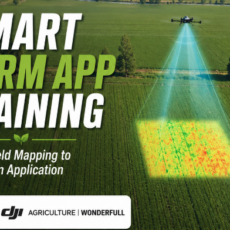
Map It Right teaches you how to build accurate, reliable field maps for real agricultural drone operations. You’ll learn how to set field boundaries, identify and mark obstacles, create safe buffers and no-spray zones, choose the right mapping method, and verify positioning before starting a mission.
By the end of this module, you’ll know how to:
- Create accurate field boundaries
- Choose the right mapping method for the field
- Mark trees, poles, power lines, and other hazards
- Set buffer zones and no-spray areas
- Understand how RTK affects mapping accuracy
- Check your map before starting a mission
- Recognize common mapping mistakes before they become field problems
Get the map right first. Everything that follows depends on it.