
Last week, we had the opportunity to attend an event focused on dry bean breeding, crop protection, and field research in Canada.
We went in with the perspective of people who work with agricultural drones. But after listening to presentations on breeding, potato leafhopper, bacterial diseases, herbicide resistance, molecular testing, weed management, and tolerance to heat, drought, and flooding, we found ourselves thinking about a much broader question:
In an increasingly complex production and research environment, what problems should agricultural drones actually be helping us solve?
The answer may not be as simple as replacing one piece of equipment with another.
Many of the challenges we heard throughout the day pointed to the same underlying issue: field problems are becoming more complex, while researchers and growers still have limited time to detect them, understand what is happening, and respond.
That is why we believe the value of drones deserves to be considered beyond spraying alone.
They can begin with field observation—helping us see unusual crop responses earlier and narrow down where closer investigation may be needed. Once researchers or agronomists understand what is happening, drones may also provide another way to intervene when timing and field conditions make conventional approaches difficult.
In other words, rather than thinking about a drone as a single machine, we are beginning to see the potential for a connected workflow:
Observe → Detect → Verify → Decide → Act → Measure Again
From Drone’s perspective, it would be
M3M→NDVI → AGRONOMIST→ AG Drone (T100) → Measure Again
The First Challenge Is Not Always How to Treat a Problem, but How Early We Find It
One presentation that stayed with us focused on potato leafhopper.
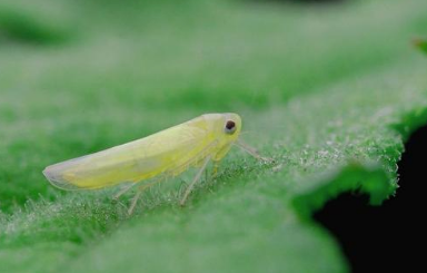
The material presented at the event noted reported yield reductions of approximately 20% and emphasized that leafhoppers can be present throughout the growing season. Scouting thresholds also change as dry beans progress through different growth stages.
That raises a very practical question.
When someone is managing a relatively small field, detailed scouting may be manageable. But as an operation expands to hundreds or thousands of acres—or when a research team is responsible for large numbers of plots, treatments, and replications—simply deciding where to look first becomes a challenge of its own.
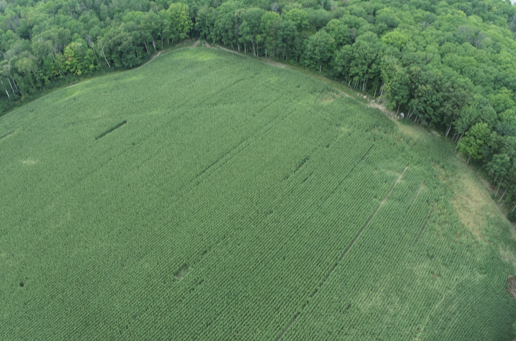
Many forms of crop stress are not immediately visible from the road. By the time an affected area becomes obvious through widespread yellowing, curling, stunting, or plant decline, we may no longer be looking at the earliest stage of the problem.
This is where we believe aerial remote sensing can play a useful role.
Its first job does not need to be telling us exactly what disease or insect is present.
A more useful first question may simply be:
Where should I look first?
Multispectral Imaging Should Not Replace the Agronomist. It Should Help the Agronomist Know Where to Look.
RGB and multispectral imagery allow us to observe a field at a scale that is difficult to achieve from the ground alone.
When crops experience water stress, insect pressure, disease, nutrient limitations, root problems, or other environmental stresses, changes may begin to appear in canopy colour, density, growth patterns, or spectral response.
But there is an important limitation that needs to be stated clearly:
An unusual vegetation index is not a diagnosis.
A similar spectral response could be associated with drought, insects, root disease, nutrient deficiency, soil variability, or even mechanical damage.
For that reason, we do not see drones or AI replacing the judgement of researchers and agronomists.
Their value may be much more practical:
Helping turn a 500-acre field into a handful of locations that are actually worth walking into and investigating.
The drone can help find the anomaly.
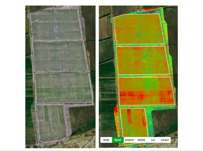
The researcher or agronomist can find the reason.
Connecting those two steps may be far more valuable than simply generating another layer of data for someone to manage.
Herbicide Resistance: The Right Question May Not Be “Should We Spray Again?”
The discussion around Group 14 herbicide resistance was another part of the event that gave us a great deal to think about.
The presentation discussed weeds surviving post-emergence applications of Reflex, with species of concern including redroot pigweed, green pigweed, and common ragweed. It also highlighted the limited post-emergence alternatives available in dry beans.
From an application-technology perspective, it would be easy to look at surviving weeds and immediately ask:
Should we spray again?
Resistance research reminds us why the real question is more complicated.
If weeds remain alive in certain areas after an otherwise normal application, we first need to understand why.
Was it application coverage?
Timing?
Weed growth stage?
A localized miss?
Or is there a resistance issue that deserves further investigation?
A drone image cannot answer those questions by itself.
But it may help us do something else that matters:
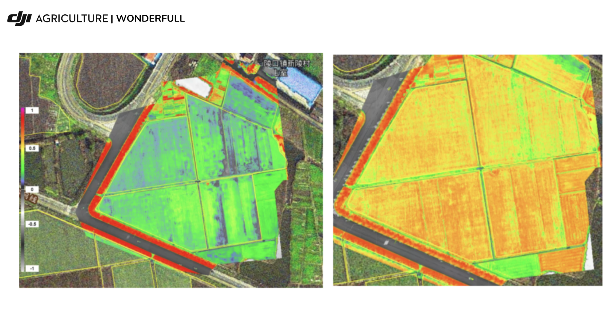
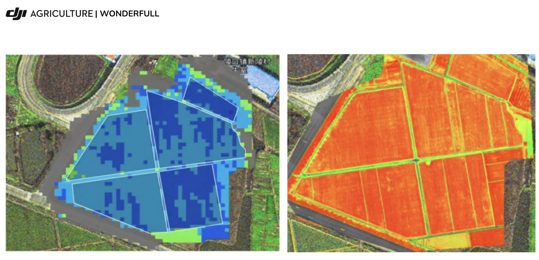
Locate the abnormal areas and create a record of exactly where they occurred.
For example, a field could be surveyed before an herbicide application to establish a baseline, and surveyed again afterward to help identify areas where weeds continue to survive or grow.
Those areas could then become targeted scouting locations rather than requiring someone to search the entire field again.
Over multiple seasons, georeferenced observations could also begin to build something that has traditionally been difficult to maintain consistently:
A spatial history of the field.
When did the problem first appear?
Does it return in similar locations?
Is the affected area expanding?
What changed after different treatments?
None of these observations prove herbicide resistance.
But they may help researchers and agronomists make a much better decision about where to investigate and where to sample next.
Molecular Testing: Perhaps the Drone’s Best Role Is Helping Us Decide Where to Collect the Leaf
The presentation on molecular testing made this relationship even clearer to us.
The researchers discussed several advantages of molecular testing. Sample collection can be relatively straightforward, requiring only leaf tissue, and turnaround time can be quick.
They were equally clear about its limitations.
Resistance caused by non-target mechanisms may not be detected, potentially resulting in a false negative. Testing is generally limited to specific weed species and herbicide groups, and a positive result does not necessarily indicate resistance to an entire herbicide group.
Listening to this, our first thought was not:
Can a drone replace molecular testing?
It was almost the opposite:
Can a drone help make field sampling for molecular testing more targeted?
Imagine a large field where surviving weeds appear after a normal herbicide application.
Finding those areas through ground scouting alone can require considerable time.
A future workflow might look something like this:
Drone Survey → Flag Abnormal Zones → Ground Truthing → Targeted Sampling → Molecular Testing → Management Decision
The drone we recommended to use during the Drone Survey is DJI Mavic 3 multispectral
The drone performs the broad screening.
Researchers verify what is actually happening on the ground.
The laboratory performs the diagnostic work it is designed to do.
The agronomist and grower make the management decision.
Each part of the system does what it does best.
We believe this is a much more useful—and scientifically defensible—approach than expecting AI to simply tell a grower, “There is herbicide resistance here.”
For Researchers, the Value of a Drone May Begin Long Before Spraying
Another project that particularly caught our attention focused on heat, drought, and flooding tolerance.
The field trial presented at the event included 30 varieties, multiple treatments, and four replications, with irrigated and non-irrigated conditions being compared as part of a collaborative research effort.
When we saw the trial design, our first thought was not about spraying.
It was:
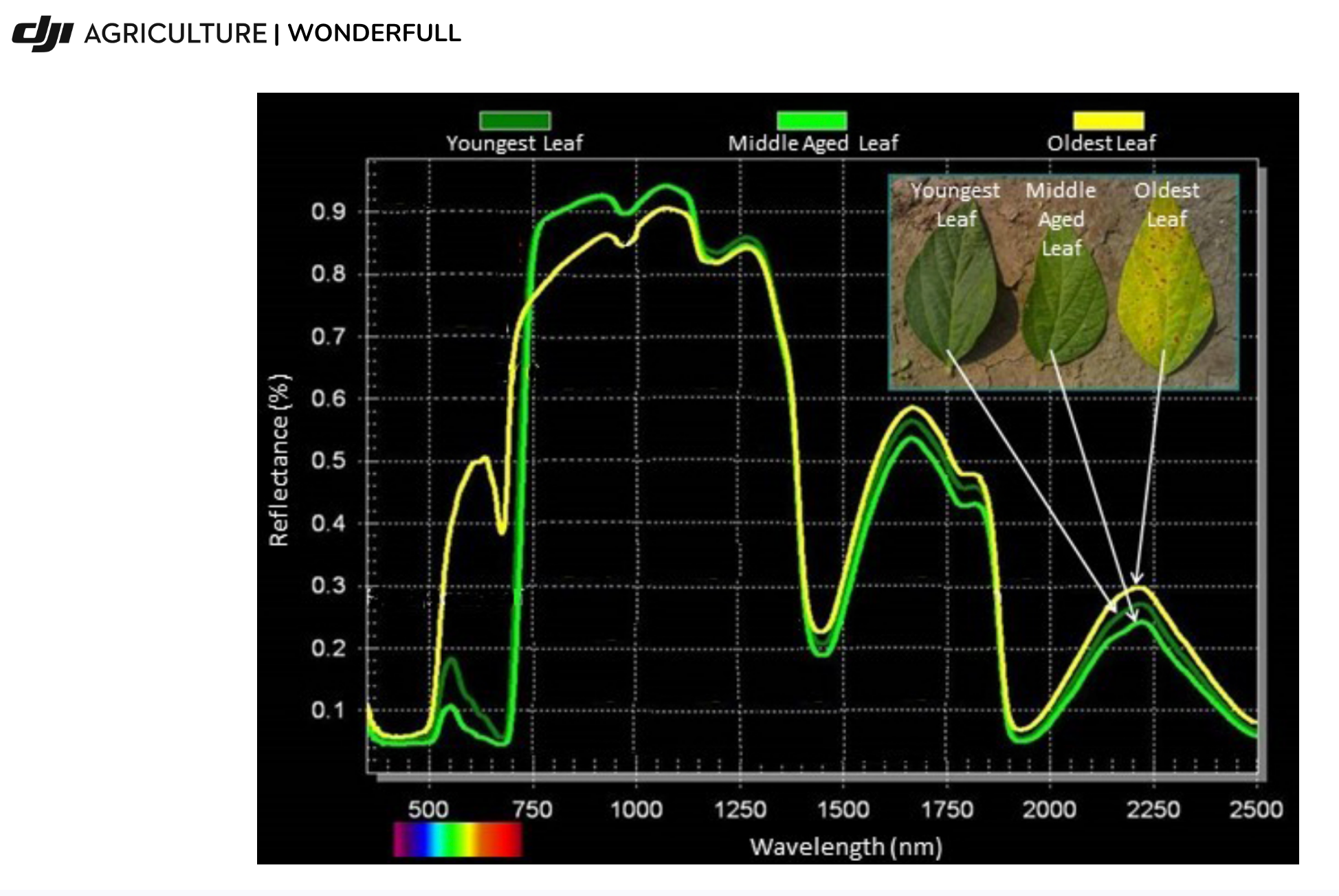
This could be an interesting environment for repeatable UAV phenotyping.
Traditional field ratings are extremely important, and drones do not make them less valuable.
But if RGB and multispectral data could be collected at several key growth stages using a consistent platform and reasonably standardized flight and sensor parameters, researchers might gain something in addition to individual field observations:
A crop-response record that develops over time.
Which varieties begin showing stress earlier?
Under non-irrigated conditions, do some varieties show a different canopy response from others?
At what point do differences between treatments begin to emerge?
If moisture conditions improve, do varieties differ in the way their canopies recover?
And perhaps most importantly, how do UAV-derived measurements relate to traditional field ratings, final yield, seed size, and other agronomic measurements?
We do not assume we already know the answers to these questions.
But we think they are worth testing.
The Real Role of AI May Be Reducing the Data Burden, Not Replacing Scientific Judgement
Once a drone begins flying a trial every week or two, another challenge quickly appears:
Data volume.
Thirty varieties, four replications, multiple treatments, and several observation dates across a growing season can generate a considerable amount of imagery and measurements.
The problem can gradually shift from:
“We don’t have enough data.”
to:
“We don’t have enough time to review all of the data.”
This is where AI-assisted analysis and automated data processing may become genuinely useful.
The goal does not need to be an algorithm that automatically declares, “This plot has Disease X.”
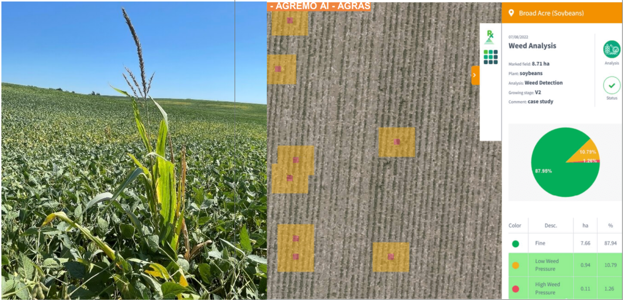
A more practical use may be comparing observations over time, flagging plots showing unusual rates of change, identifying areas that differ from the surrounding crop, or helping researchers generate more consistent measurements from large imagery datasets.
AI can help with the first screening.
The researcher determines what has biological and agronomic significance.
That division of work may ultimately be more useful than trying to automate scientific judgement itself.
Plant Breeding Does Not Need More Pretty Maps. It Needs Useful, Repeatable Measurements.
The presentation on the University of Guelph bean breeding program also made us think differently about where UAV technology might fit.
From the early years of the program to today’s work on disease resistance, environmental stress, maturity, and genetic improvement, progress in plant breeding has come through years of crossing, selection, field evaluation, and validation.
The discussion around Common Bacterial Blight resistance illustrated this particularly well.
Developing useful resistance has involved identifying sources of resistance, introducing desired traits through crossing, and then working through multiple stages of selection over many years before material becomes useful in commercial production.
A drone does not change the biology of plant breeding.
But it may help make some aspects of phenotyping more frequent and more consistent.
A researcher may traditionally have a limited amount of time to manually rate a large number of plots.
Aerial data could potentially provide a spatial record of the entire trial first, helping researchers ask:
Which plots are beginning to behave differently from the overall population?
This does not replace the breeder’s eye.
It may simply help put the breeder’s eyes in the places where they are most valuable.
From Detection to Action: This Is Where Larger Agricultural Drones Enter the Picture
Remote sensing can help answer:
Where should we look?
Agronomy and research help answer:
What is actually happening?
Production agriculture eventually has to answer a third question:
What can we do about it—and can we do it in time?
This is something we have repeatedly encountered in our work with potatoes, onions, and other crops.
Sometimes the need for crop protection is already clear, but weather and field conditions do not cooperate.
Following prolonged rainfall, soils may temporarily be unable to support large ground equipment. Later in the season, driving machinery through a developed crop may also increase crop damage and soil compaction.
Disease and insect pressure, however, do not wait for the field to dry.
In these situations, larger agricultural drones do not have to be viewed as replacements for ground sprayers.
They provide another option.
When ground equipment is the most efficient and appropriate tool, it should be used.
But when wet ground, crop height, localized treatment needs, or a narrow application window limits conventional equipment, a drone may provide another way to intervene in time.
The same concept may apply to certain spreading and cover-crop establishment applications, where appropriate and where permitted by local regulations, product labels, and agronomic requirements.
This is why we increasingly hesitate to think of a large agricultural UAV simply as a “spray drone.”
We see greater potential in thinking of it as: A field intervention platform.
Precision Agriculture Should Not End With a Map
Agriculture has become very good at producing data.
Satellite imagery, yield maps, soil maps, RGB imagery, multispectral imagery, weather data—the list continues to grow.
But more data does not automatically mean less work for a grower or researcher.
If a map ultimately sits on a computer and does not influence what happens in the field, it has not solved much.
The next challenge for precision agriculture may therefore be:
How do we close the loop?
How do we connect:
Sensing → Agronomy → Decision → Application into one useful workflow?
For example, in an ideal—but still to be validated—system, a UAV could first complete a whole-field survey.
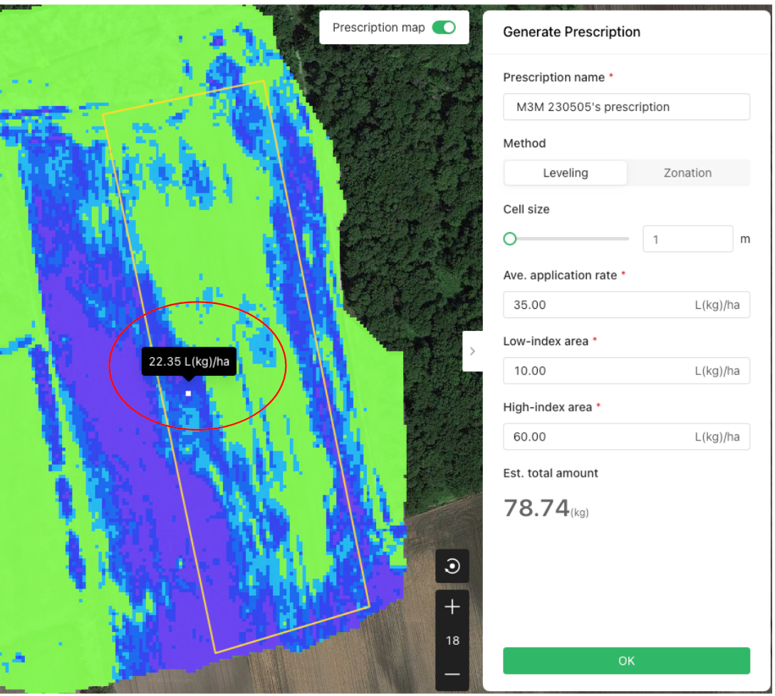
Data analysis could help flag unusual areas.
A researcher or agronomist would then ground-truth those locations.
Where appropriate, tissue sampling, molecular testing, or other diagnostic methods could follow.
Once the problem is understood, a management decision can be made.
If crop protection is required, the most appropriate application platform can then be selected.
And afterward, the field can be measured again to evaluate the crop response.
At that point, a drone is no longer simply a machine that makes maps or applies products.
It becomes one part of a broader decision loop.
We Left the Event With More Questions—and We Think That’s a Good Thing
After attending this event, we did not leave believing we had discovered a “drone solution” to every challenge in dry bean production.
Quite the opposite.
We left with more questions.
Could multispectral data help researchers identify stress differences earlier in dry bean field trials?
Under drought, pest pressure, or herbicide treatments, what relationships might exist between UAV-derived measurements, traditional field ratings, laboratory testing, and final yield?
Could UAV surveys help researchers develop more efficient sampling strategies when investigating surviving weeds?
In a field trial with 30 or more varieties, how much repetitive scouting could repeatable UAV phenotyping reduce—and how many additional useful observations might it provide?
From anomaly detection to ground truthing and, eventually, field intervention, can we develop a workflow that actually works under Canadian production conditions?
We do not want to assume the answers.
We would rather test them in real research plots and commercial fields.
Because the presentations we heard reinforced something important:
The hardest problems in agriculture are rarely solved by one “magic technology.”
The real challenge is connecting breeding, agronomy, crop protection, field experience, and new technology in the right way.
Perhaps the Next Step Is to Keep Asking the Right Questions
For researchers, drones may be able to reduce some of the repetitive work involved in field scouting, leaving more time for the observations and decisions that require scientific expertise.
For agronomists, they may help identify where closer investigation is most valuable.
For growers, once a problem has been confirmed, larger agricultural drones may provide another option for timely field intervention when conditions make other approaches difficult.
And for us, the biggest takeaway from the event was not discovering more places where we could “use a drone.”
It was gaining a clearer understanding of where the technology should—and should not—fit.
Drones should not attempt to replace the experience of researchers, agronomists, or growers.
Good agricultural technology should help that experience work more effectively.
If remote sensing can help us see unusual crop responses earlier; if data analysis can help narrow hundreds of acres down to a few locations worth investigating; if researchers can then verify and sample those locations more efficiently; and if growers can ultimately act at the time the crop actually needs it—
then the value of agricultural drones goes far beyond putting a sprayer in the air.
The event left us with a better understanding of the questions that still need to be explored: where UAV technology can provide meaningful value, where its limitations remain, and how it might fit alongside existing research, agronomy, and production practices.
We do not want to assume the answers.
The most useful starting point is not asking where we can use a drone, but understanding the field problem first—and then asking whether the technology has a meaningful role to play.
WONDERFULL INC.
Transport Canada Recognized RPAS Flight School
Certified Advanced Flight Reviewer
Drone Compliance | Academy Training (DJI Standard) | Sales & Service
Office: 647-800-7952
Text: 647-287-6851
5955 10 Sideroad
Innisfil, ON L0L 1K0
Canada