This is an agricultural miracle. When modern farmers use advanced agricultural tools to participate in production and field decision-making, everything is under accurate big data calculation, farmers can monitor the growth of crops from time to time, and predict the growth of crops within a few hours before and after, we can think that this is a big step forward and a milestone in using data to manage farms, and our farmers are finally starting to say goodbye to empiricism.
The technological power brought by artificial intelligence and big data computing has enabled the intelligence of agricultural machinery. These agricultural robots can help farmers work all day and night. At the same time, technology has made the work of farmers a very attractive industry.
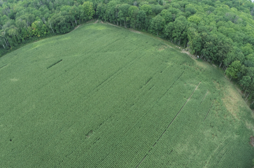
Crop field Mapping
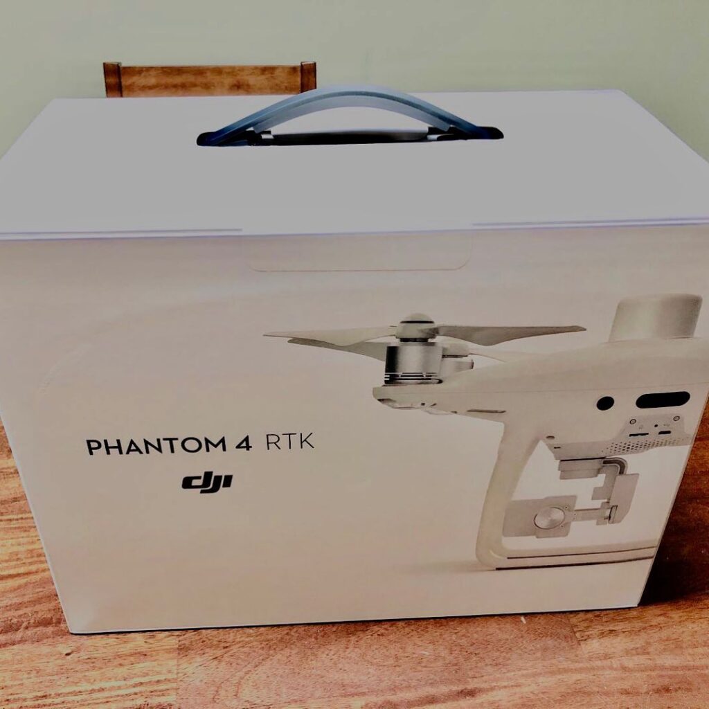
The photo was taken from the DJI Phantom 4 RTK drone.
And this technology goes out to every farmer and drone pilot at the forefront of agriculture. Scouting the farm more efficiently and clearly.
Modern farms need to be equipped with cutting-edge technology, maintain the leading position in the industry, further effective work and greatly reduce operating costs.
The future of farming has never been brighter.
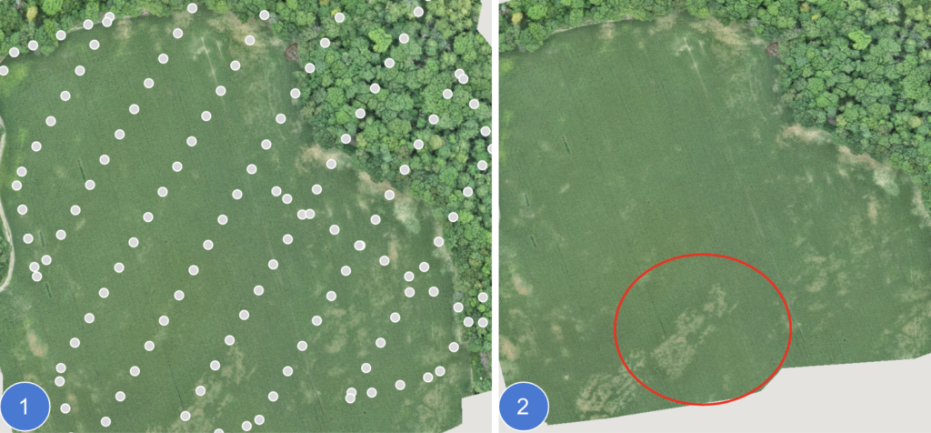
You can choose any size of the area where the problem can be seen with the naked eye for more effective P4 RTK drone operation. Treat wherever there is a problem.
If you have different crops in a patrolled area, you can also select the plot that needs to be operated and then use DJI Agras T20 or T30 to work on the plots that need to be operated in this way.
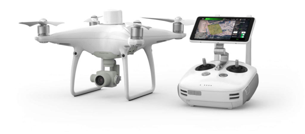
—Professional aerial mapping and surveying drone.
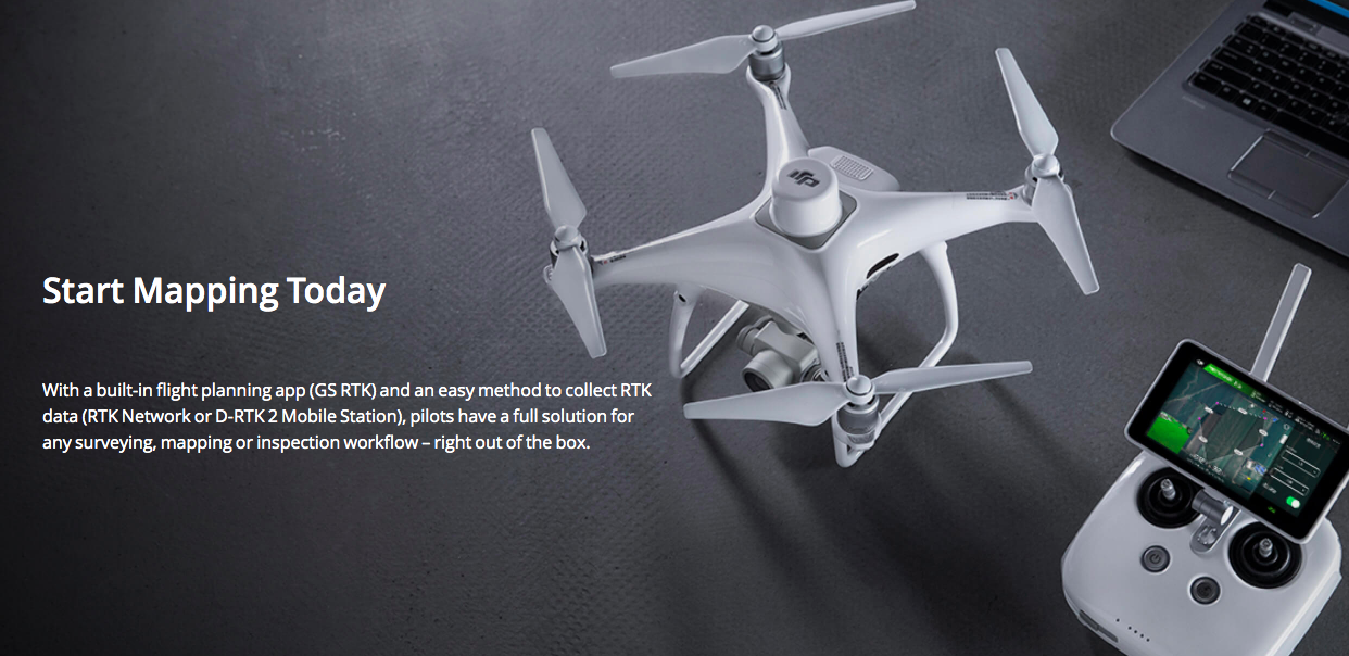
DJI Phantom 4 RTK is a start-to-end solution to map, survey, RTK, PPK, track, monitor, map, and measure your plot, worksite, farm field, and anywhere that you need to measure.
This is the way that can help you acquire aerial data much easier so that the data that you needed can be processed, visualized, measured, and communicated.
DJI Phantom 4 RTK is used to manage and improve site measuring and monitoring operations for Nature resources, Farm-fields, Utilities, Construction, and Engineering.
The drone is not restricted by the environment and terrain, is flexible, precise, accurate, efficient, and fast, and has low surveying and mapping costs. It can easily help you to collect target information for the project area in a comprehensive way, and provide engineers with the required surveying and 3D data at any time.
There’s no doubt that it is an advanced tool to help you improve efficiency and simplify many traditional operating steps.
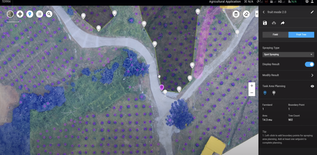
Orchard Field Application
There’s a total of 902 trees in the selected area.
DJI P4RTK can not only plan the 2D map but also create 3D spray maps. Wondering how many fruit trees you have on your farm? This drone could help you with
So, what is the application of AI big data to calculate the number of these trees in autonomous spraying?
DJI spraying drones can accurately spray according to the fixed amount of mixed liquid for each tree set by the agronomist or grower. It can spray the canopy hovering, rotating spray, and continuous spraying.
http://thmiii.com/test-post-for-kk/If you have 100 trees, and the spray volume per tree is set to 0.3L. Then 100 trees need a total of 30L of the mixture, which will not be sprayed more or used less.
The distance between trees is not sprayed, thus saving material.
Having a drone make a 3D map and then automatically spraying pesticides by spraying the drone sounds like a highly technical process. But in practice it is very simple to operate.
First use a Phantom 4 RTK drone to fly over the orchard farmland to automatically take high-definition photos, and then transfer the data to a laptop for image processing; DJI Terra software will perform 3D modelling and AI route planning, after that, you Insert the data card into the DJI Agras T series drones, and they can automatically read the map and spray according to the calculated route.
DJI said that drones can now perform fully automatic operations in irregular orchards, automatically avoiding obstacles such as buildings, ponds and wires, and the entire process requires no human intervention at all.
According to reports, in 2019, the system has passed the training of more than 1 million fruit tree pictures, and can complete 30Acres full-environment recognition in less than 1 minute. Up to 20 types of fruit trees have been identified, including apples, citrus, mangoes, bananas, dragon fruit and more. The fruit tree recognition accuracy rate reached 97%.
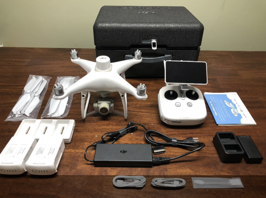
Product introduction
Phantom 4 RTK retains the original quality of the Phantom 4 Pro series, adds an RTK navigation and positioning system, and comprehensively upgrades the whole machine for low-altitude photogrammetry operations.
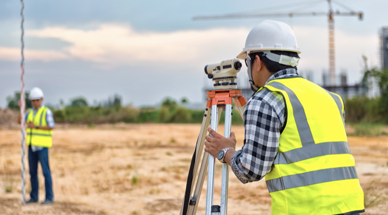
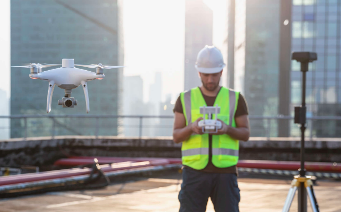
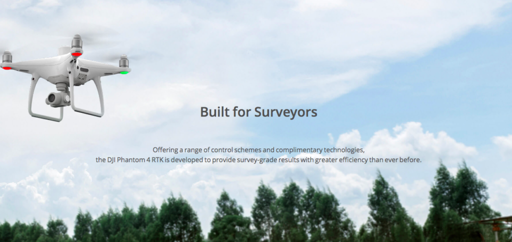
Why drones are becoming go-to tools for surveying professionals and what’s the perfect surveying starter drone?
Click the title to read more.
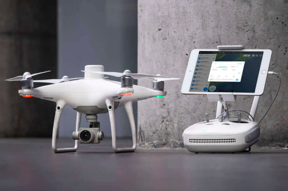
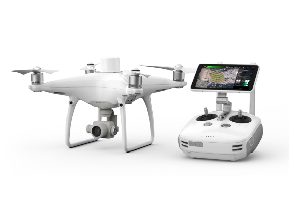
Phantom 4 RTK
Unobstructed at a glance
Phantom 4 RTK is a small multi-rotor high-precision aerial survey unmanned aerial vehicle for low-altitude photogrammetry applications. It has a centimeter-level navigation and positioning system and a high-performance imaging system
The Phantom 4 RTK combines a centimeter-level navigation and positioning system with a high-performance imaging system, integrated in a compact and portable body, which improves the efficiency and accuracy of aerial surveys, and reduces the difficulty and cost of operations. For mapping operations, the accuracy and efficiency are extremely important.
Visionary Intelligence. Elevated Accuracy.
Upgrade your next mapping mission with the Phantom 4 RTK – the most compact and accurate low altitude mapping solution.
Next Generation Mapping
DJI has rethought its drone technology from the ground-up, revolutionizing its systems to achieve a new standard for drone accuracy – offering Phantom 4 RTK customers centimeter-level accurate data while requiring fewer ground control points, the operation process is simplified, and the time cost is reduced.
1cm+1ppm RTK Horizontal Positioning Accuracy
1.5cm+1ppm RTK Vertical Positioning Accuracy
5cm* (*When flying at 100m height, 2.7cm GSD, sunny.) Absolute Horizontal Accuracy of Photogrammetric Models
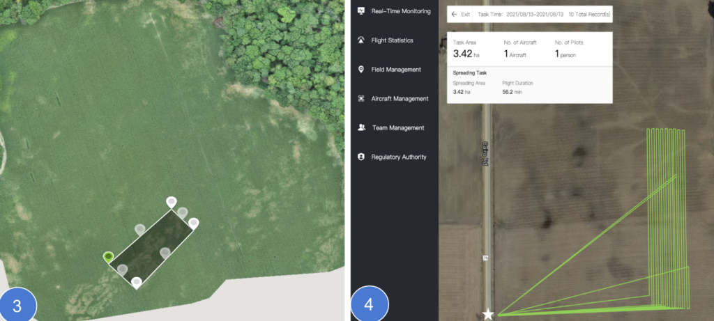
Delimit the area and check the data before uploading the route. The aircraft will take off automatically, and it will return automatically after the aerial survey is over or the battery is low.
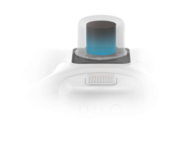
Centimeter-Level Positioning System
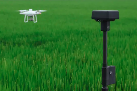
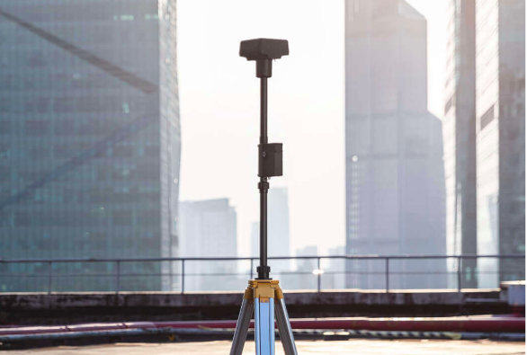
A new RTK module is integrated directly into the Phantom 4 RTK, providing real-time, centimeter-level positioning data for improved absolute accuracy on image metadata. In addition to optimized flight safety and precise data collection, the Phantom 4 RTK stores satellite observation data to be used for Post Processed Kinematics (PPK), which can be conducted using DJI Cloud PPK Service*. Fit the Phantom 4 RTK to any workflow, with the ability to connect this positioning system to the D-RTK 2 High Precision GNSS Mobile Station, or NTRIP (Network Transport of RTCM via Internet Protocol) using a 4G dongle or WiFi hotspot.
Gather Accurate Data with TimeSync
To take full advantage of the Phantom 4 RTK’s positioning modules, the new TimeSync system was created to continually align the flight controller, camera and RTK module. Additionally, TimeSync ensures each photo uses the most accurate metadata and fixes the positioning data to optical center of the lens – optimizing the results from photogrammetric methods and letting the image achieve centimeter-level positioning data.
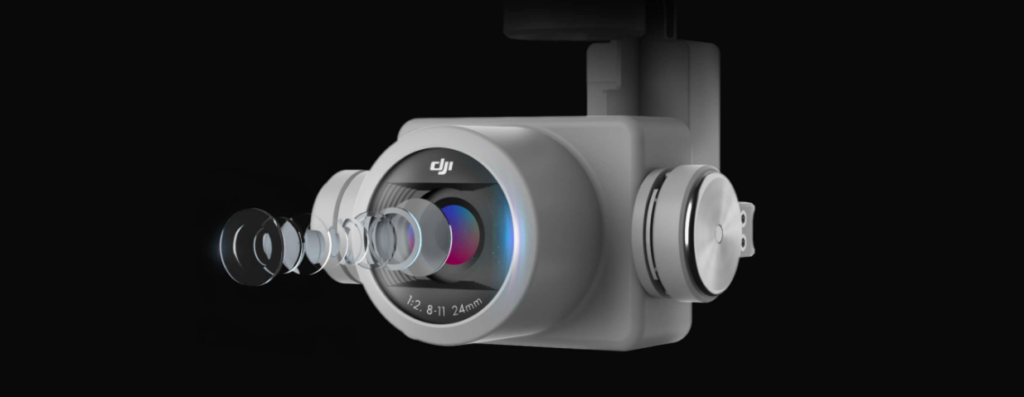
Precise Imaging System
Capture the best image data with a 1-inch, 20-megapixel CMOS sensor. Mechanical shutter makes mapping missions or regular data capture seamless as the Phantom 4 RTK can move while taking pictures without the risk of rolling shutter blur. Due to the high resolution, the Phantom 4 RTK can achieve a ground sample distance (GSD) of 2.74 cm at 100 meters flight altitude.To ensure each Phantom 4 RTK offers unparalleled accuracy, every single camera lens goes through a rigorous calibration process, with parameters saved into each image’s metadata, letting post-processing software adjust uniquely for every user.
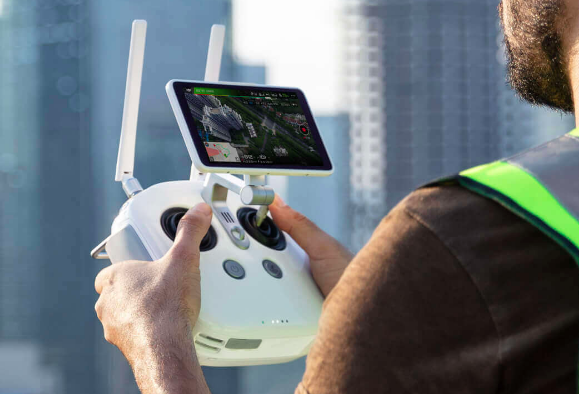
Purpose-Built Application
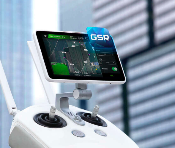
A new DJI GS RTK app and Remote Controller with built-in screen, giving users a streamlined control scheme for surveying missions and other data acquisition scenarios.The GS RTK app allows pilots to intelligently control their Phantom 4 RTK, with multiple planning modes, including Photogrammetry (2D and 3D), Waypoint Flight, Terrain Awareness, Block Segmentation*, and more. Users can also import KML/KMZ files to optimize the workflow for their missions.With the built-in screen, pilots can clearly view and plan their missions on an ultra-bright, 5.5-inch HD display.
Access a Variety of 3rd Party Applications
Pilots with experience using 3rd party apps on DJI drones can access the world’s leading drone app ecosystem for their Phantom 4 RTK with the SDK Remote Controller. Users can plug in a compatible Android or iOS device and install any compatible DJI Mobile SDK-enabled app to harness the full power of their Phantom 4 RTK.
OcuSync Transmission System
Enjoy stable and reliable HD image and video transmission at distances of up to 7 km, great for mapping larger sites*.
*Unobstructed, free of interference, when FCC compliant. Maximum flight range specification is a proxy for radio link strength and resilience. Always fly your drone within visual line of sight unless otherwise permitted.
Seamless Compatibility with D-RTK 2 Mobile Station
Support your Phantom 4 RTK missions with the D-RTK 2 Mobile Station – providing real-time differential data to the drone and forming an accurate surveying solution, or acquire accurate location coordinates when used as an RTK rover. The Mobile Station’s rugged design and OcuSync transmission system ensures you can gain centimeter-level accurate data with your Phantom 4 RTK in any condition.