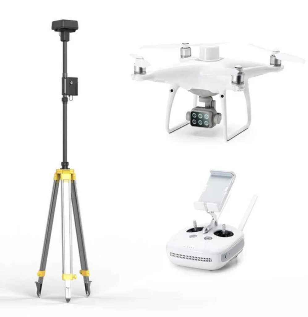
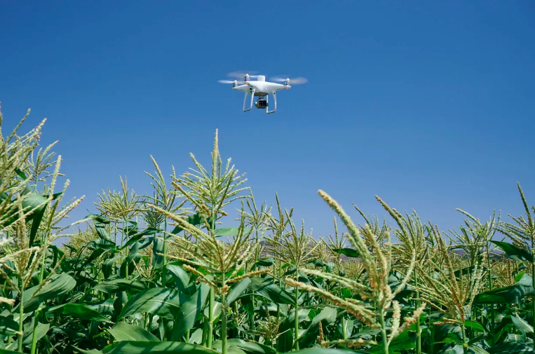
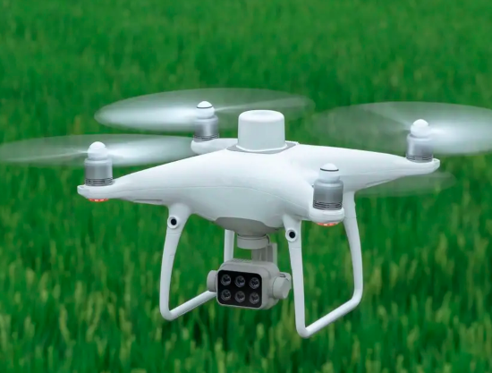
P4M is an integrated high-precision multispectral imaging drone launched by DJI. It creates the convenience of worry-free operation. You will never have to worry about the data is not timely, the prescription map making time is long, and it is not easy to use. After downloading the images, it only takes about 10 minutes to generate the variable-rate prescription map, so that you can use your Agras drones for the disease area management. Greatly improved work efficiency.
The core of smart agriculture is actually a whole agriculture smart system, is to achieve the entire process of agricultural production precise data processing, information perception, quantitative decision-making, intelligent control, precise investment, and a new agricultural production method with personalized service.
Apply digital agricultural solutions to agricultural production to promote the sustainable development of global agriculture; The P4M drone is a great tool to help agronomist to determine in-season nutrient deficiencies or insect & disease pressures timely, to help farmers produce sufficient, safe, and high-quality agricultural products.
We offer free training on the equipment so that you can learn quickly and USE-friendly. It effectively solves the inconvenience of the time delay of the commonly used satellite multi-spectrum and the data error caused by the interference of sun-ray by the regular photo conversion. These timely and accurate multi-spectral data are combined with the professional knowledge of agronomists, and with the precise spraying drones, it is only necessary to set the amount of pesticides and fertilizers required in the corresponding area according to the prescription map, and no need for large-scale carpet operations. , which can significantly reduce dosage and save water, while minimizing the impact of pests and diseases, and increasing crop yield crops, which are of great benefit to farmers and wider environmental management.
In daily agricultural management, we usually need to use multi-spectral technology to monitor the growth and health status of crops at various stages in combination with actual production management, so that farmers and agronomists can make timely farmland management judgments and the best decisions.
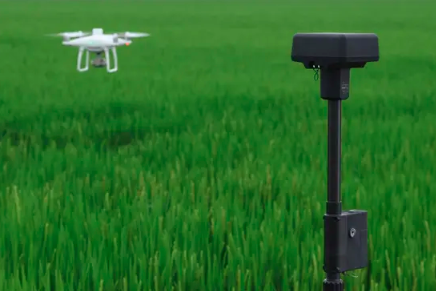
DJI P4M multi-spectral drones are mostly used for crop emergence monitoring, nutrition monitoring, weed monitoring, land level inspection, etc. The monitoring results integrate with precision AG drones solutions, from identifying crop health conditions on each stage to the protection work at the right time to deliver precisely in the dose that can be quickly and effectively combined with DJI Agras drones for variable-rate operation.
Nutrient and disease Monitoring:Agronomists give the advice and chemicals needed for crop growth in a timely manner, growers generate variable spray prescriptions for nutrient solutions or chemical control solutions, and then you can use any of these DJI Agras drones (T10, T20, T30 ) for variable rate. It is a complete solution to apply uniform growth of crops throughout the crop cycle, resulting in maximum biomass throughout the field and ultimately maximum crop yield.
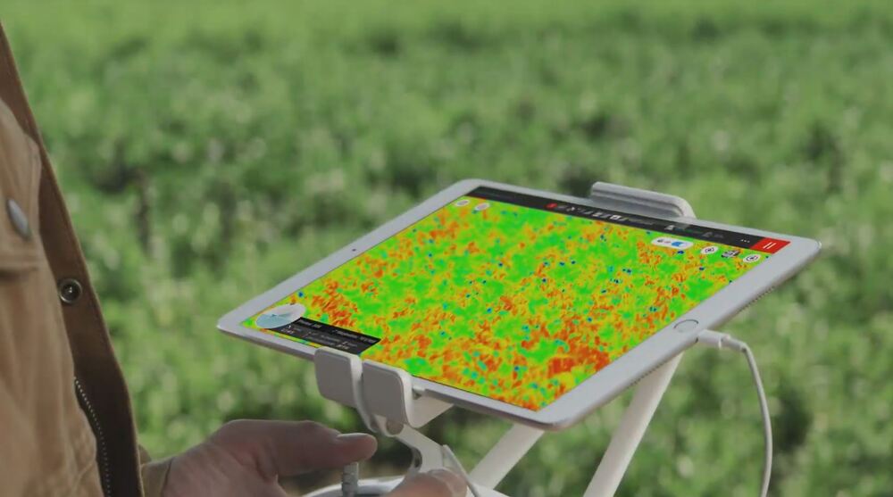
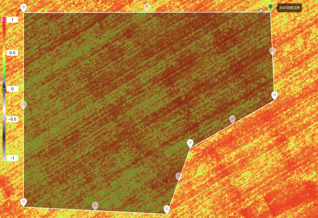
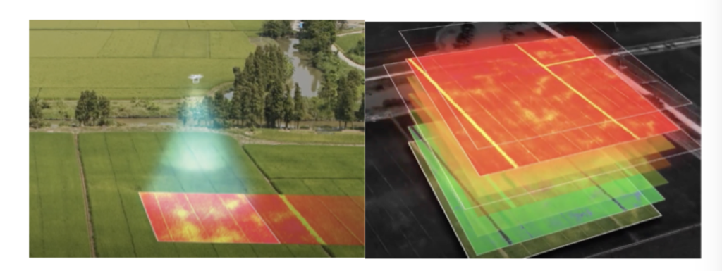
The P4M can easily generate farmland prescription maps through the DJI Smart Agriculture Cloud Platform, and perform variable fertilization. Increase the amount of fertilizer to promote growth in areas with weaker growth in the field.
This is the first week of P4M images.
One week after variable fertilization, the crop growth situation has been greatly improved.
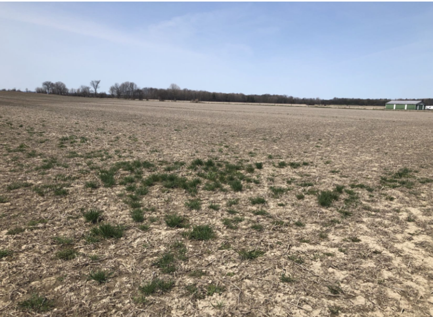
Due to the timely discovery of the problem, the agronomist proposed a targeted fertilization program for the soaked seedlings. “In the past, the output could only be calculated at the time of harvest. Now we can know in time what is wrong in every production link.”
This is the second week of P4M images, you can see that one week after variable fertilization, the growth situation has been greatly improved.
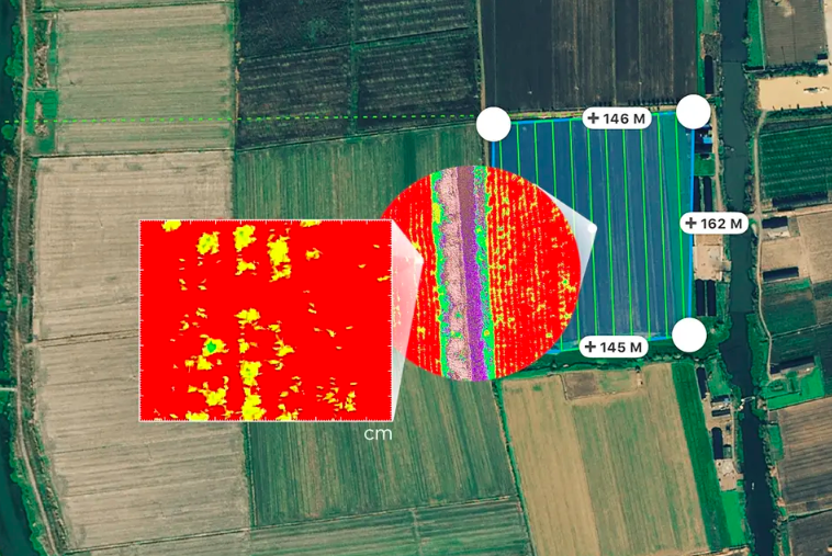
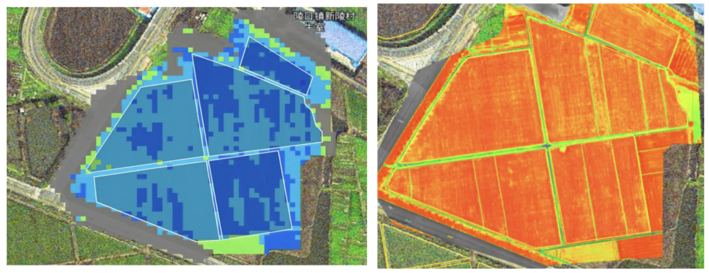
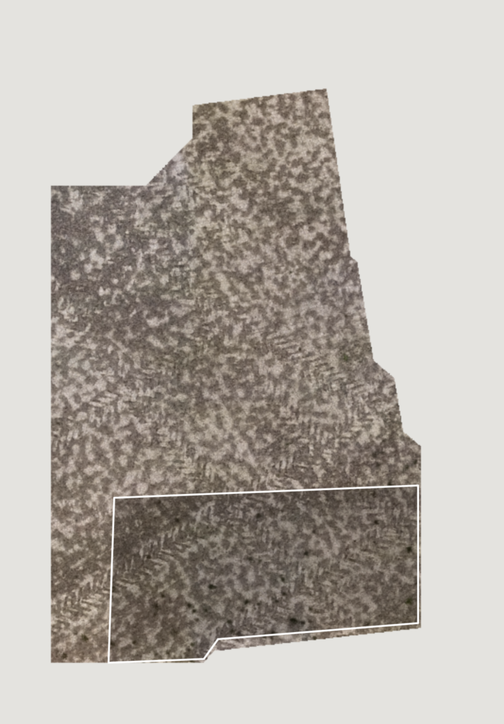
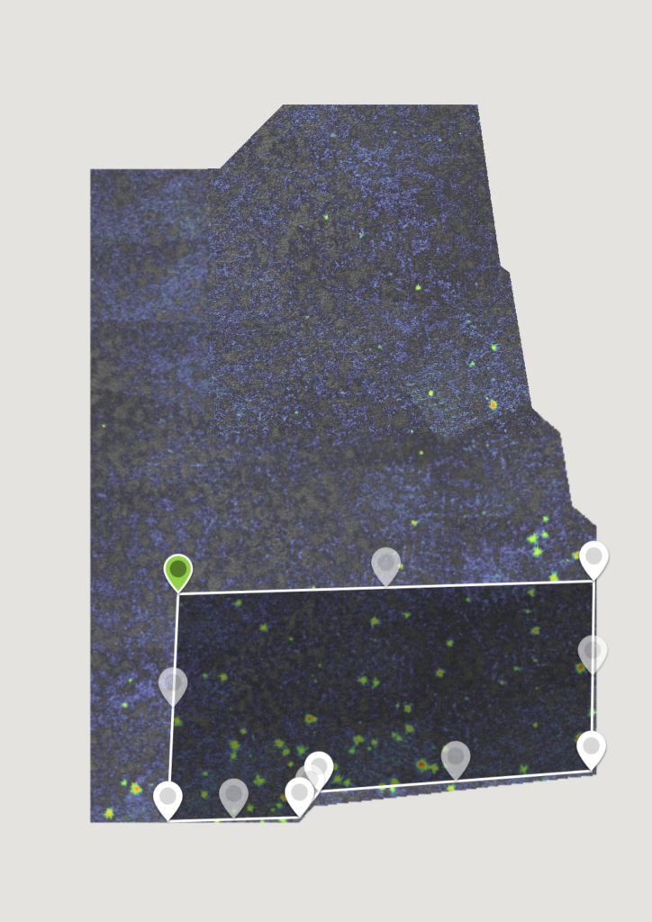
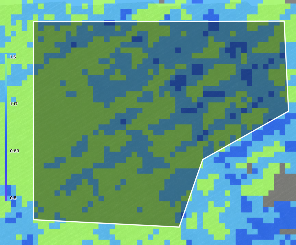
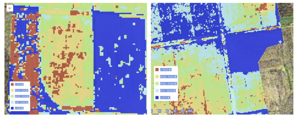
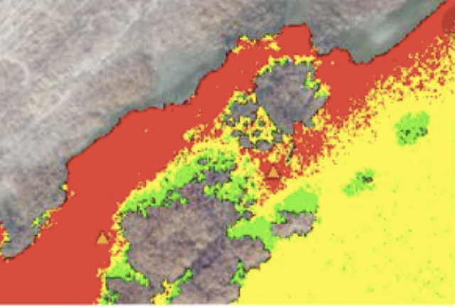
The above blue image shows the level of the land.
Easily generate farmland prescription maps through the DJI Smart Agriculture Cloud Platform, and perform variable fertilization. Increase the amount of fertilizer to promote growth in areas with weaker growth in the field.
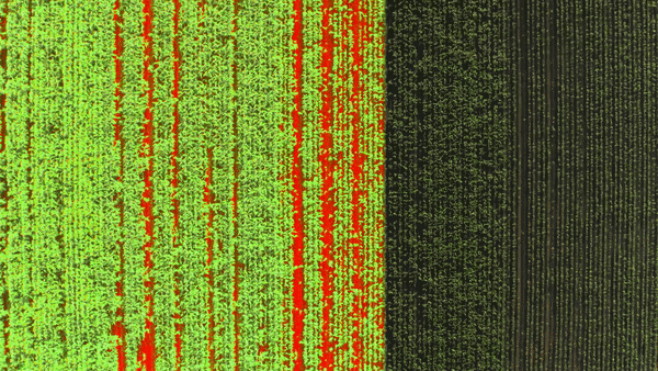
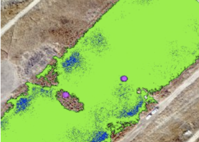
This is the third week of P4M images. It shows that after the multi-spectral variable operation, the crops in the field are growing evenly (which you can see that health crops shows in red).
This variable operation method can accurately control the amount according to the growth of crops in different areas of the farmland, thereby promoting the crops. According to the data, the regular crops can be managed in this way, and the seedlings can basically be achieved neatly height in 3 operations, which not only reduces the application of pesticides, but also improves the efficiency of the operation.
Weed Inspection:These multi-spectral data will help to accurately determine weed areas, whether crops are stressed by weeds, and agronomists can use this data to make variable application plans for spot spray treatments.
This precise soil and crop data enables farmers to save time and money more efficiently, while significantly reducing the use of pesticides and fertilizers.
Precision variable spraying is one of the basic needs of precision agriculture.
Each field may have different diseases, pests and weeds, and different soil components. If it is not based on the actual situation, just uniform operation will cause waste of pesticides or fertilizers and loss of profits.
How to deal with uneven emergence?
A variable rate is an accurate operation based on the analysis of crop growth in advance and the multi-spectral prescription map. Apply according to the crop’s demand for pesticides and fertilizers and do not spray where it is not needed.
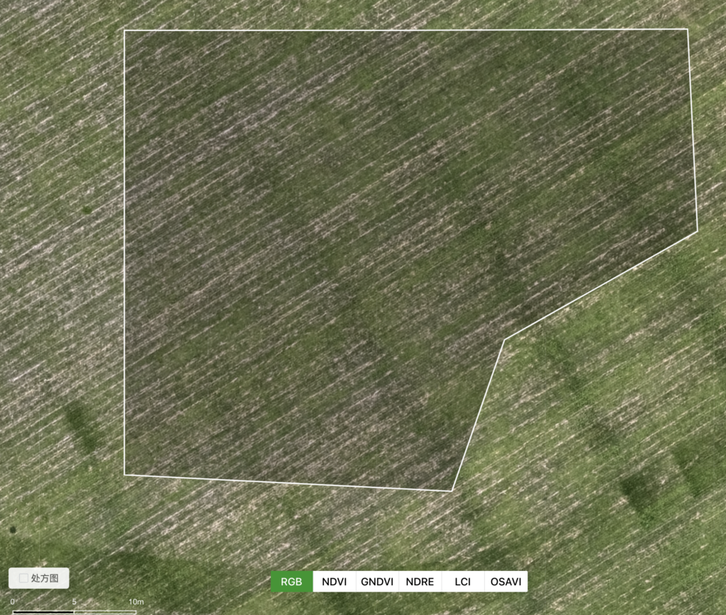
This is an easy-to-operate software that allows you to select any target plot that you need to work on.
How to use farmland prescription maps efficiently?
Simply put, it is to spread more fertilizer in areas with weak growth, and less or not spread in areas with better growth, thereby further improving farmland yield, reducing costs, and ultimately improving planting benefits. The operation is the same for pest/disease outbreak areas.
After the DJI P4M scans the crop field, you can directly select any area on the target area, upload the data to Terra software to perform variable operations on the DJI Agras series drones. Save another 30-50% on doses and increase yields by around 10%!
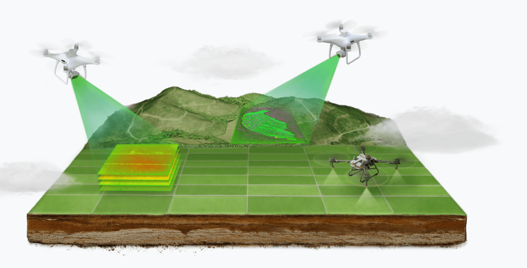
P4 Multispectral integrates the process of capturing data to help farmers and agronomists gain insight into the entire process of crop health and vegetation management. This platform helps the systematic operation of precision agriculture, from diagnostic maps to variable operations can be easily achieved.
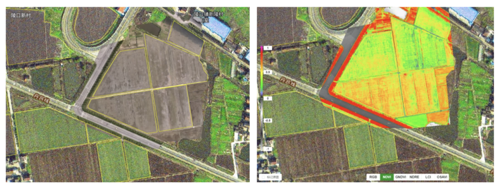
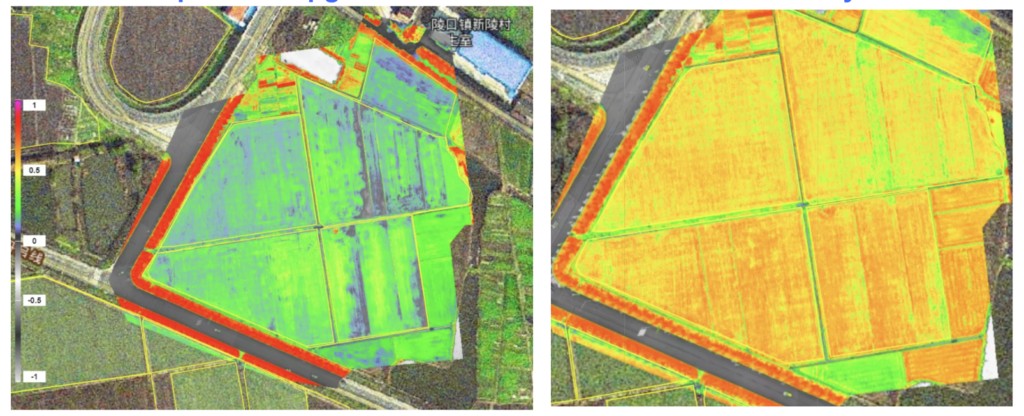
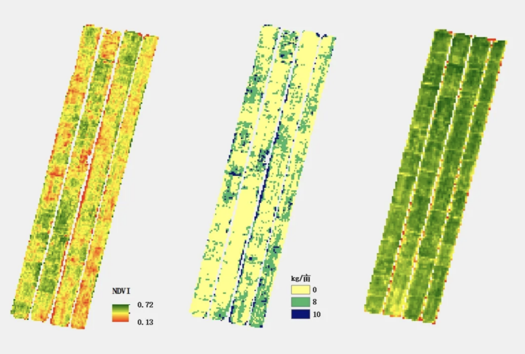
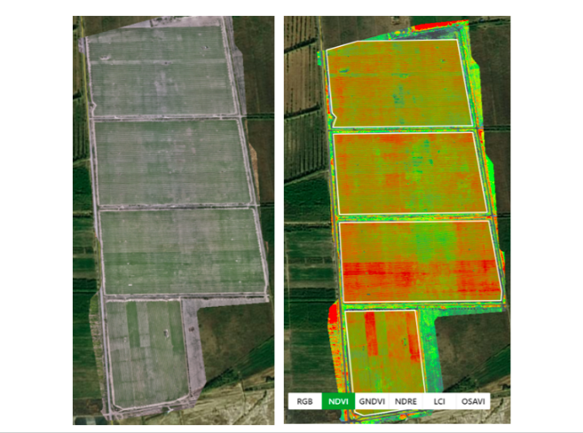
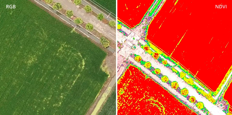
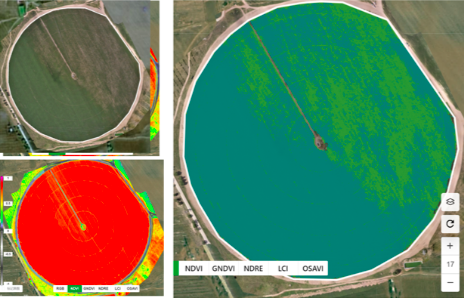
It can be seen from the NDVI index graph that there is a big difference in field growth in the late tillering stage. Based on this NDVI map, the agronomist divided the field growth and formulated the fertilization rate gradient to generate a fertilization prescription map. Subsequently, the prescription map was imported into T20, and the variable fertilizer operation was carried out.
DJI 2 in 1 spray/spread drones will automatically operate variable based on the application rate in different areas. No human intervention is required throughout the process.
With the help of Phantom 4 Multispectral drone you could determine the right amount dosage of fertilizer or pesticide to your farmland at any time. To improve your work efficiency, save your cost, and increase your yield.
land level Inspection:Color distinctions on multispectral images give farmers an intuitive understanding of crop growth, and elevation maps show land levels. “Look at the picture below, the more consistent the colours, the smaller the gap between the fields and the flatter the fields.
By monitoring the flatness, targeted land preparation can be carried out to improve and balance the flatness of the land.
Agricultural specialization
In the fertilization process, an experienced agronomist can accurately grasp the amount of fertilizer used according to the growth of the crop.
Through drone patrols and data records, the efficiency and effectiveness of crop data collection in farmland are effectively improved, and agronomists are freed from repetitive and tiring field patrols, focusing on formulating agronomic plans and serving a broader range of planting acreage to improve the overall management level of farmland.
For agronomists, this management upgrade eliminates the need for field patrols. This is of great significance for improving the degree of farmland informatization and for upgrading and optimizing the agricultural development model.
In the process of planting, timely adjustment of fertilizer and dosage can not only reduce costs and increase income, but also improve crop quality.
* Environmental monitoring
The DJI Phantom 4 multi-spectral drone can help insights to monitor forest health, measure biomass, map coastlines or manage riparian vegetation, while protecting habitats or ecosystems, etc
It makes daily inspection and maintenance involving plants smarter and more efficient.After setting up the route through RTK, the DJI Phantom 4 multi-spectral drone will automatically perform tasks such as exploration, data analysis, image collection, and input.
Through the changes in the chlorophyll of algae or weeds in the water, the vegetation coverage and development trends in the water can be monitored, which can help effectively manage water resources in a timely manner.
Agricultural schools and professional research institutes can be used for scientific research in vegetation, hydrology, agriculture, forestry, remote sensing and other fields;
* Land classification
Using vegetation index map, can automatically distinguish vegetation, water surface, building, etc., can be used for urban green area survey, urban and rural planning and design, etc.
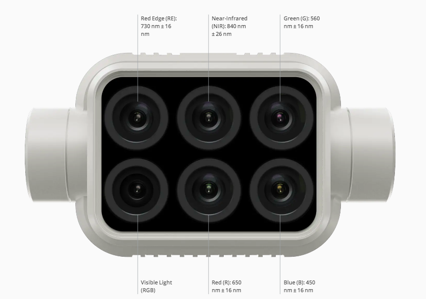
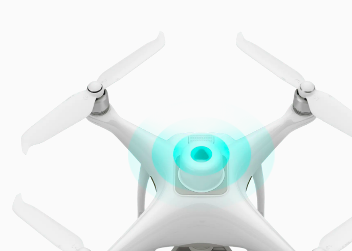
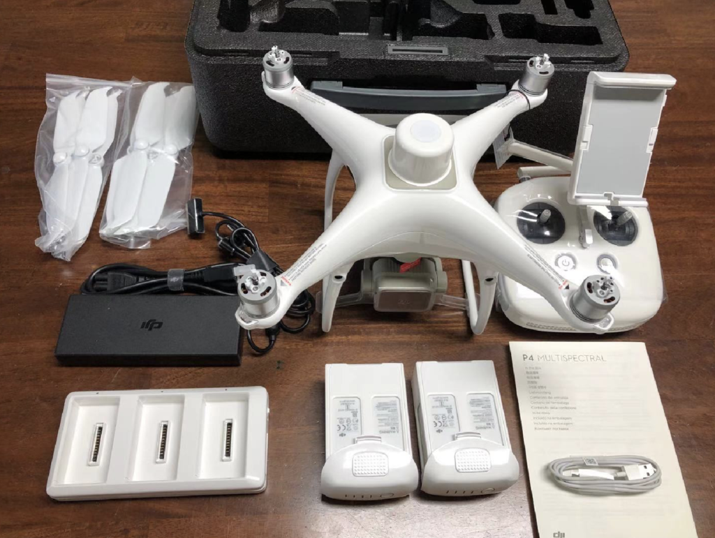
The Phantom 4 Multispectral drone is equipped with an integrated multispectral imaging system, which integrates 1 visible light sensor and 5 multispectral sensors (blue, green, red, red edge, and near-infrared). Each sensor has a 2 million resolution and juxtaposed displacement. The overall imaging system is mounted on a three-axis pan-tilt and can output contrast data.
Plant Intelligence for Targeted Action
Gather precise plant-level data using the P4 Multispectral – a high-precision drone with a seamlessly integrated multispectral imaging system built for agriculture missions, environmental monitoring, and more.
Early-stage: Accurate multi-spectral index maps can in-depth analysis of crop and soil conditions, fertility data, and optimize fertilization by detecting nutrient deficiency. Help with land management, whether to produce or convert crops, etc.
Mid-term: Accurately understand the emergence and growth of plants. Count the plants and determine the number of crops or planting spacing issues.
Estimate crop yield;Identify pests, diseases, and weeds.
Middle and late period: Quickly identify crop pests and diseases and crop fertility conditions. Control crop irrigation by identifying areas suspected of water stress. Check the damage of agricultural machinery to crops, and make necessary repairs or replace the problematic machinery.
Farm to Figures
See Beneath the Surface
Agriculture imagery collection is now simpler and more efficient than ever before with a built-in stabilized imaging system that collects comprehensive data sets right out of the box. Access information collected by 1 RGB camera and a multispectral camera array with 5 cameras covering Blue, Green, Red, Red Edge, and Near Infrared bands – all at 2 MP with global shutter, on a 3-axis stabilized gimbal.
Integrated Spectral Sunlight Sensor for Accurate Results
In addition, a light intensity sensor is integrated on the top of the Phantom 4 Multispectral Edition, which can capture the solar irradiance and record it in the image file. When performing data post-processing, the solar irradiance data can be used to compensate for the illumination of the image, eliminate the interference of ambient light on the data, help users obtain more accurate NDVI 1 values, and improve the accuracy and consistency of the data collected at different times.
Meaningful Data at Your Disposal
View Both RGB and NDVI Feeds
Simply having aerial imagery is not enough for ag professionals who want to know more. Switch between a preliminary Normalized Difference Vegetation Index (NDVI) analysis and the live RGB feed to immediately visualize where attention is needed, so targeted treatment decisions can be made quickly.
Centimeter-level Precision
Get real-time, accurate positioning data on images captured by all six cameras with DJI’s TimeSync system, providing centimeter-level accurate measurements. The TimeSync system continually aligns the flight controller, RGB and NB cameras, and RTK module, fixing the positioning data to the center of the CMOS and ensuring each photo uses the most accurate metadata. All cameras go through a rigorous calibration process where radial and tangential lens distortions are measured. The distortion parameters gathered are saved into each image’s metadata, letting post-processing software adjust uniquely for every user.
Enhance the accuracy of RTK positioning without internet connection by connecting the P4 Multispectral to the D-RTK 2 High Precision GNSS Mobile Station and NTRIP (Network Transport of RTCM via Internet Protocol)2, or store the satellite observation data to be used for Post Processed Kinematics (PPK).
D-RTK 2 Mobile Station and NTRIP Compatibility
The application of DJI drones is conducive to improving the utilization rate of “water, fertilizer and dosage”, which can save water and dosage.
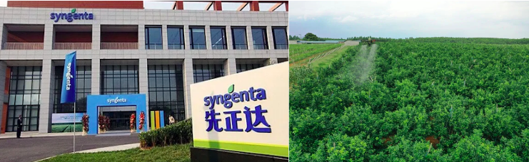
In August 2021, DJI plant protection drones were sprayed in Syngenta Group’s China Orange Demo Field. The results showed that the use of drones was 30% less than manual labor, and water consumption was more than 95% saved. That means DJI drone only use 5% around mixture to achieve the same result! And it can effectively control leaf miners, thrips, aphids, and canker diseases. Article’s link.
DJI’s plant protection drone operation can save water and dosage because its spraying atomization has a fine particle size, and it uses a small amount of water to drive the liquid to cover the peel and leaf surface through the wind field. Compared with manual spraying, the fruit trees need to be watered from top to bottom, which causes a waste of liquid medicine, and the utilization rate of liquid medicine for drone operations is higher.
(Top)Precise management and variable operation of soybean - increase yield (Right) Precise management and variable operation of potato - increase yield
In addition, drones are also used in vineyard management, fine management of fields and cash crops, New Zealand beer gardens, and Japanese tea gardens.